|
Research Blog
My research interests include high-resolution monitoring and modeling techniques to better understand groundwater flow in spatially and temporally complex geologic systems. Methods include geochemical sampling of groundwater after recharge events, fracture flow modeling, and the use of thermal imagery from drones. My study sites have included areas in Minnesota, Missouri, Pennsylvania, Florida, and now western Montana. |
|
|
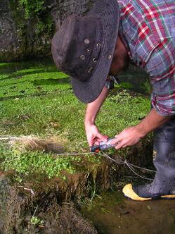
Earlier this year I was awarded a grant from the Consortium of Universities for the Advancement of Hydrologic Science, Inc. (CUAHSI), a research organization supported by the National Science Foundation to advance water science. The grant supports travel expenses in order to perform research at some additional sites while collaborating with other researchers. For my project I chose some additional spring sites at in contrasting karst settings to follow up with the rare earth element analysis that I performed in my central Pennsylvania springs. These sites were near Gainesville, Florida and Springfield, Missouri. This involved sending some equipment ahead in advance to collaborators at the University of Florida and Missouri State University, and then traveling to the sites to set up some autosamplers to collect spring water. 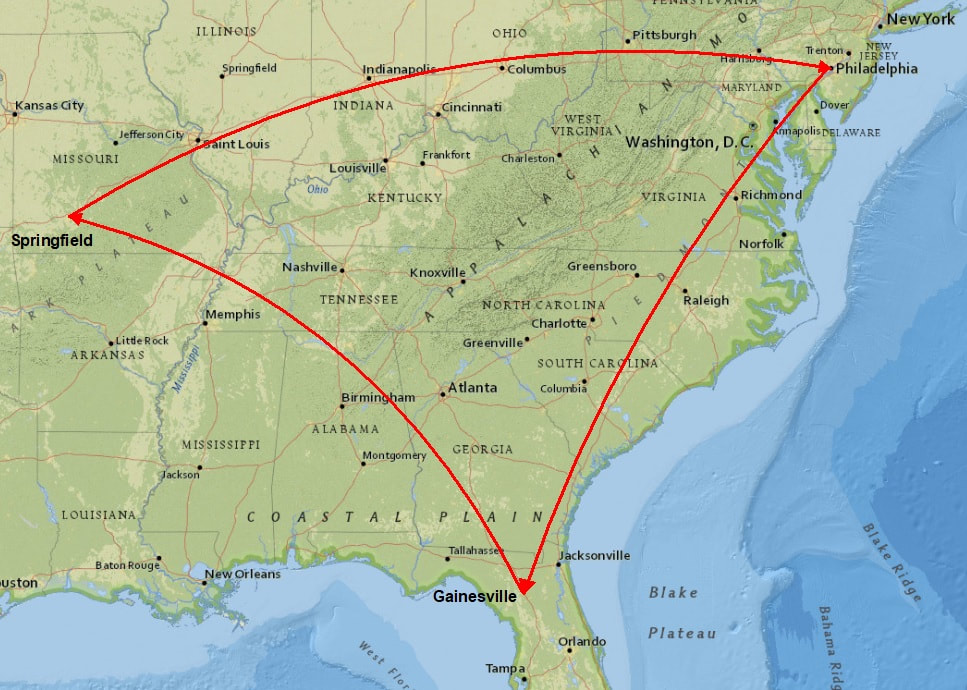 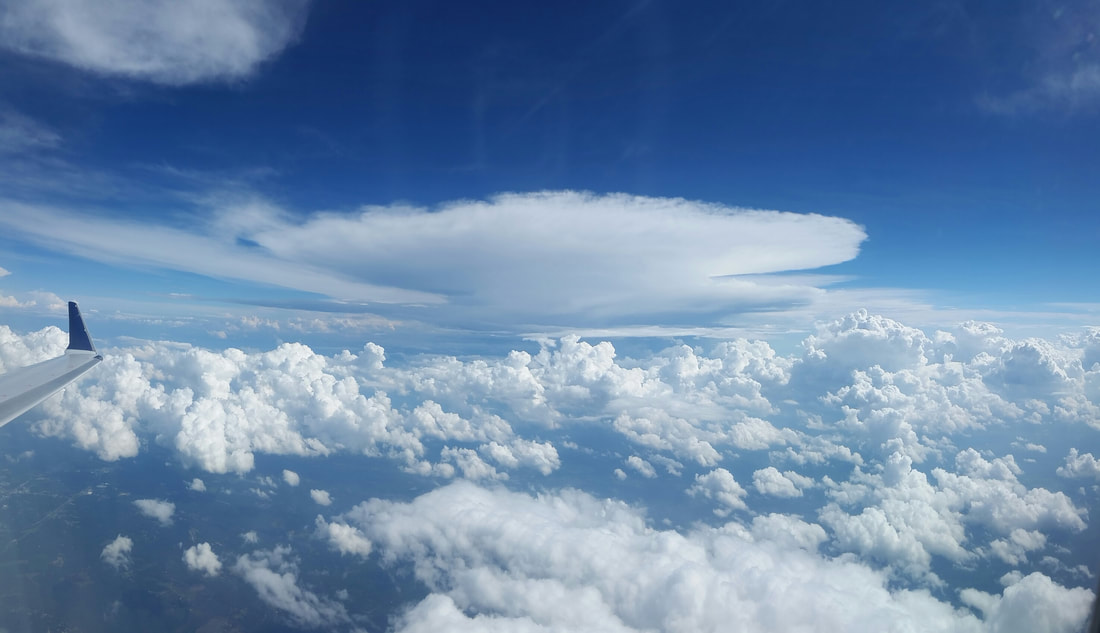 Storms headed to Florida. My first stop was Florida, visiting some sites at O'Leno State Park and Ichetucknee Springs. 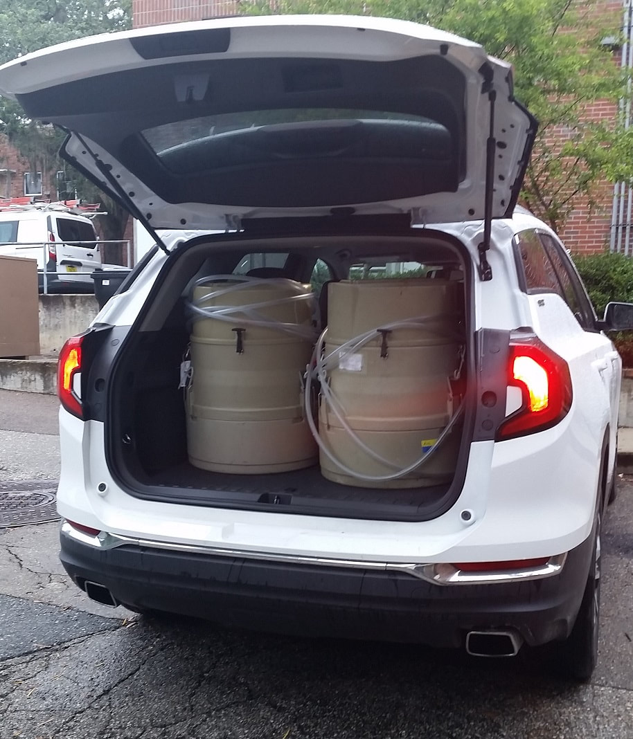 Loading up the autosamplers. 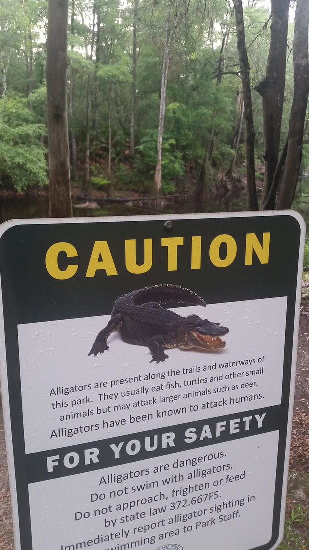 Local wildlife at O'Leno Park. 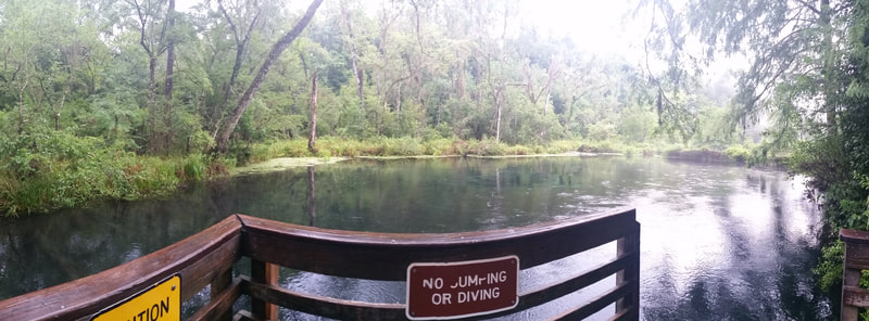 Blue Hole Spring at Ichetucknee Springs. 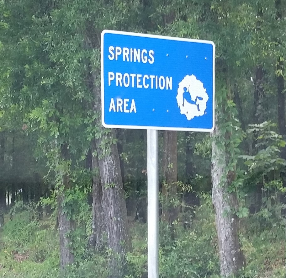 Yay for karst protection! There was no shortage of rain events while I was there (a problem I ran into often in Pennsylvania in the summer). Not wanting to risk the chance of not collecting spring samples due to some water level actuator issue I programmed the autosamplers to collect spring samples over the course of a few days. For one of the sites this meant 24 spring samples collected (no issues - woohoo!). 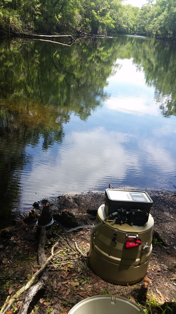 Autosampler set up at O'Leno Rise. 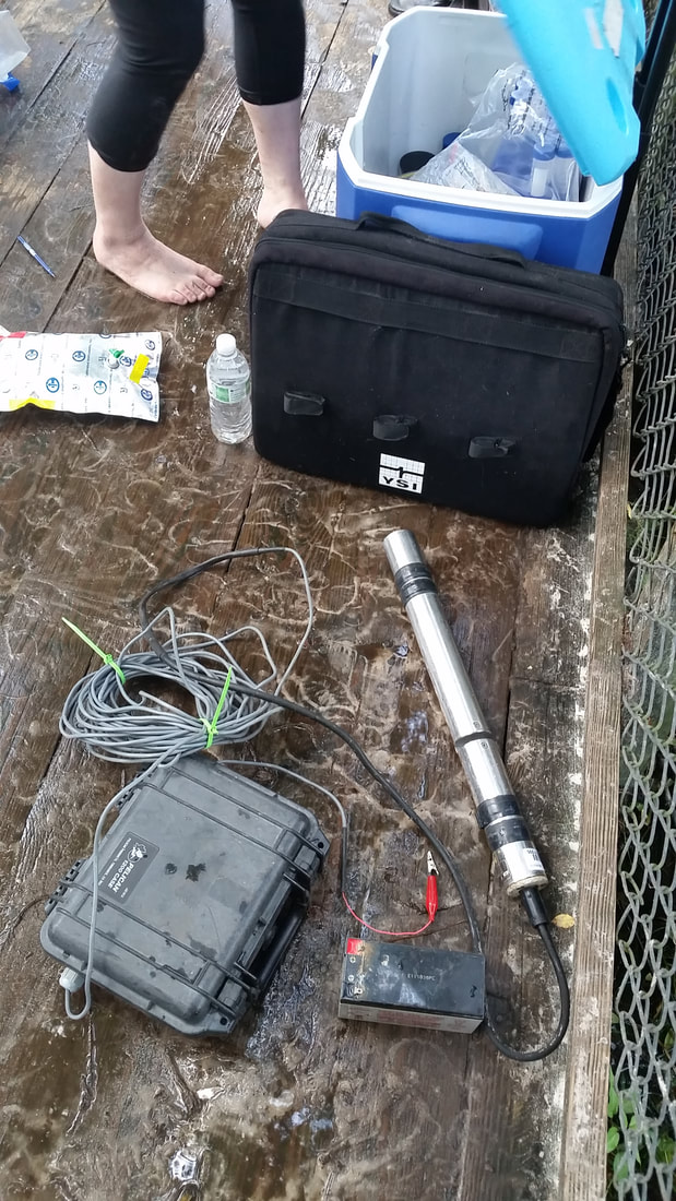 Field equipment at Blue Hole Spring. 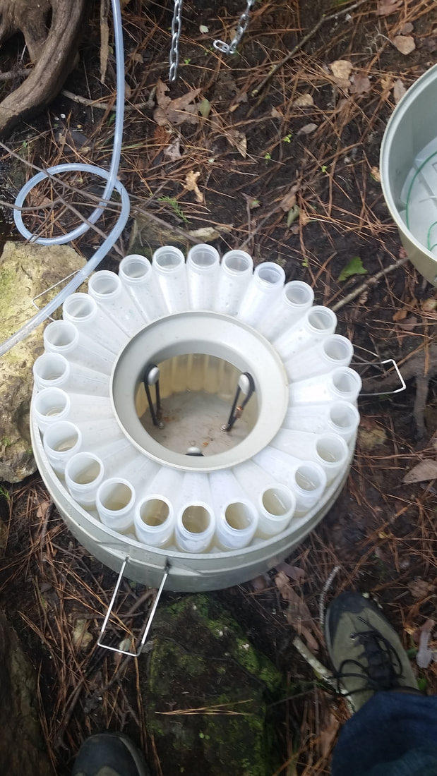 Filled sample bottles ready to be processed. The other site did have some technical issues on account of water getting into the base of the autosampler. With the bottles being empty they began to buoy upward and eventually impeding the sampler arm, so only about half of the bottles were filled. Still, plenty of samples to analyze! 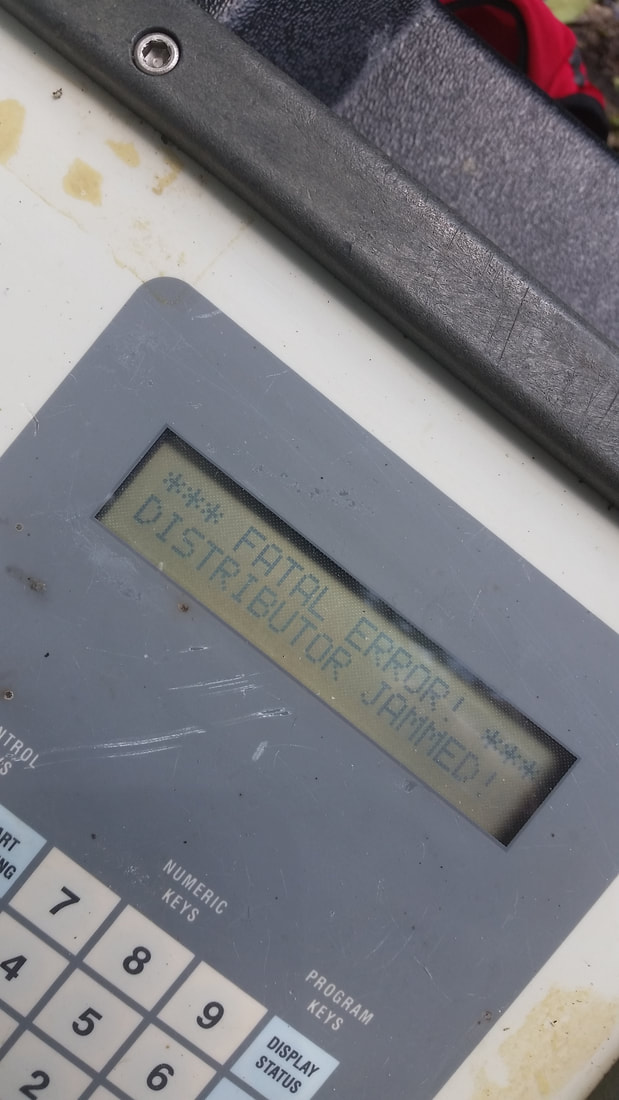 Some technical difficulties! 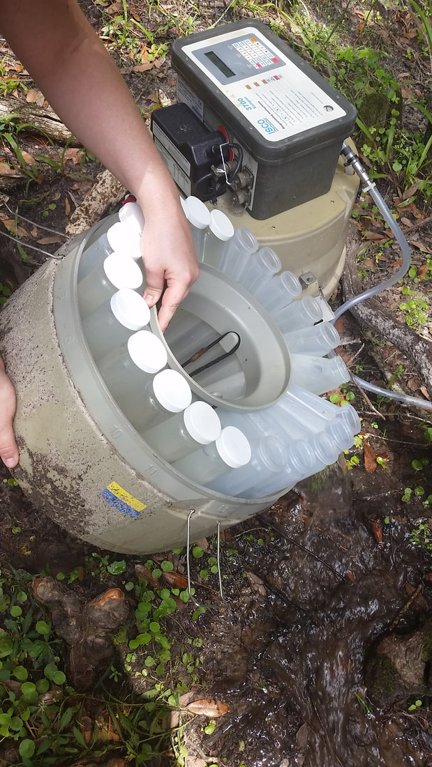 Plenty of water...just not in the bottles... Next stop was over to Springfield, Missouri to monitor some springs and sites that were actually part of my master's degree research. The luck followed me as there also was no major shortage of storms headed that way when I arrived. This resulted in another good round of spring water samples collected to be analyzed. 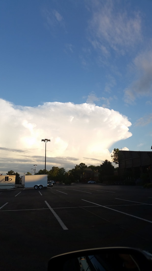 Storms headed toward Springfield, MO!  Visiting my old grad office at MSU. 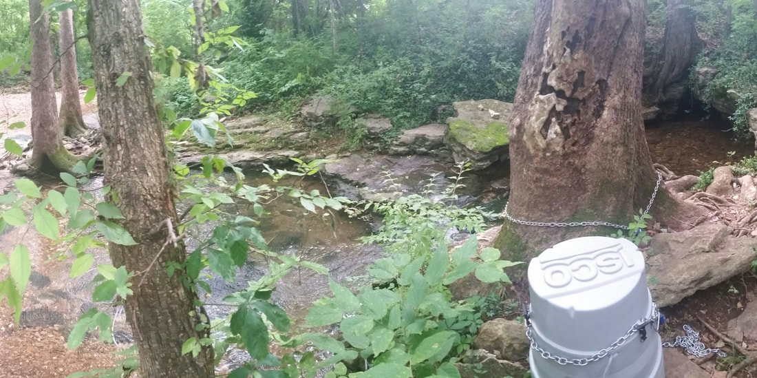 Autosampler set up at the spring! All of the samples from Florida and Missouri were filtered and acidified and sent back to Philadelphia to be organized before sent off for rare earth element and stable water isotope analysis. 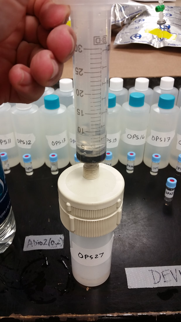 Processing spring samples. 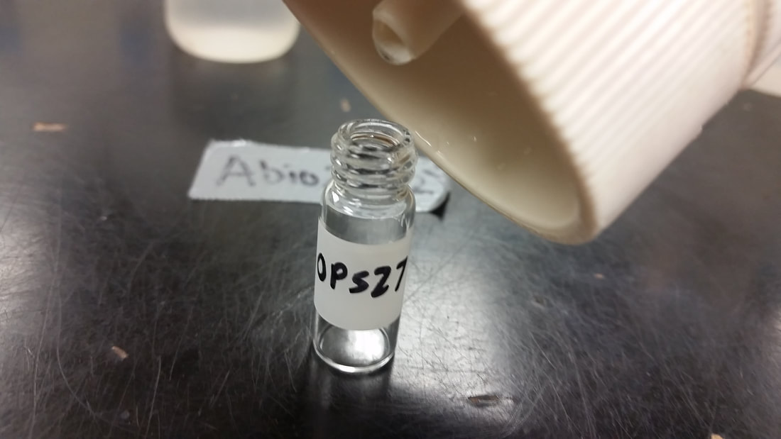 Filling stable water isotope vials. It'll be interesting to see how these results compare to our results from central Pennsylvania. A big thanks to Dr. Jon Martin at the University of Florida and Dr. Doug Gouzie at Missouri State University for agreeing to help out with the project and providing assistance for site selection and field help!
0 Comments
Back in July I bid farewell to Temple University and Pennsylvania for my move out west to start the next step in my career in Montana.  Last call at Maxi's Pizza! 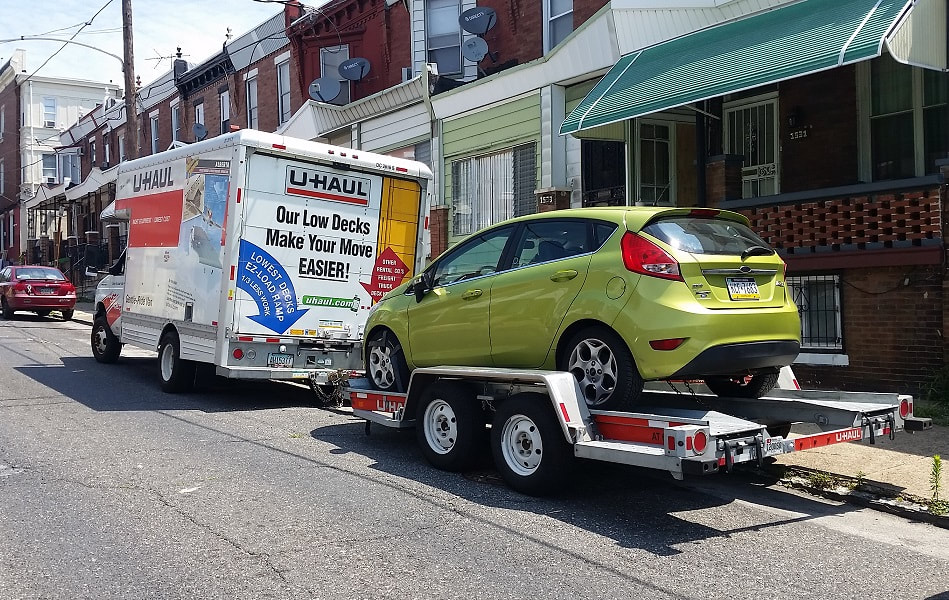 UHaul loaded up, and car trailer'd up - so long, Brewerytown! 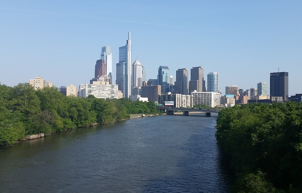 Crossing the Schuylkill River, saying goodbye to Philly! The ~35 hour drive from Philadelphia to Butte was fairly uneventful, although I did make some pit stops in Winona and the Twin Cities in Minnesota to visit friends and family for the 4th of July. 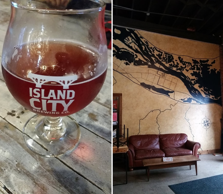 Stopping through Winona, MN to see what's new and what hasn't changed. Something new: Island City Brewing Co (left). Something that hasn't changed much: that aerial silhouette of the city (right). 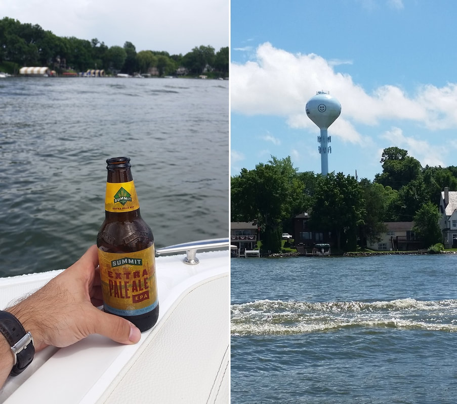 Spending a couple days with family and friends, which included some good local beer (left) and plenty of time on the water (right). That smiley face has been on Spring Park's water tower since I was born. After some Minnesota time I continued on my drive westward on I-90 through the Dakotas and into Montana, as the Great Plains slowly transformed into the Rockies. 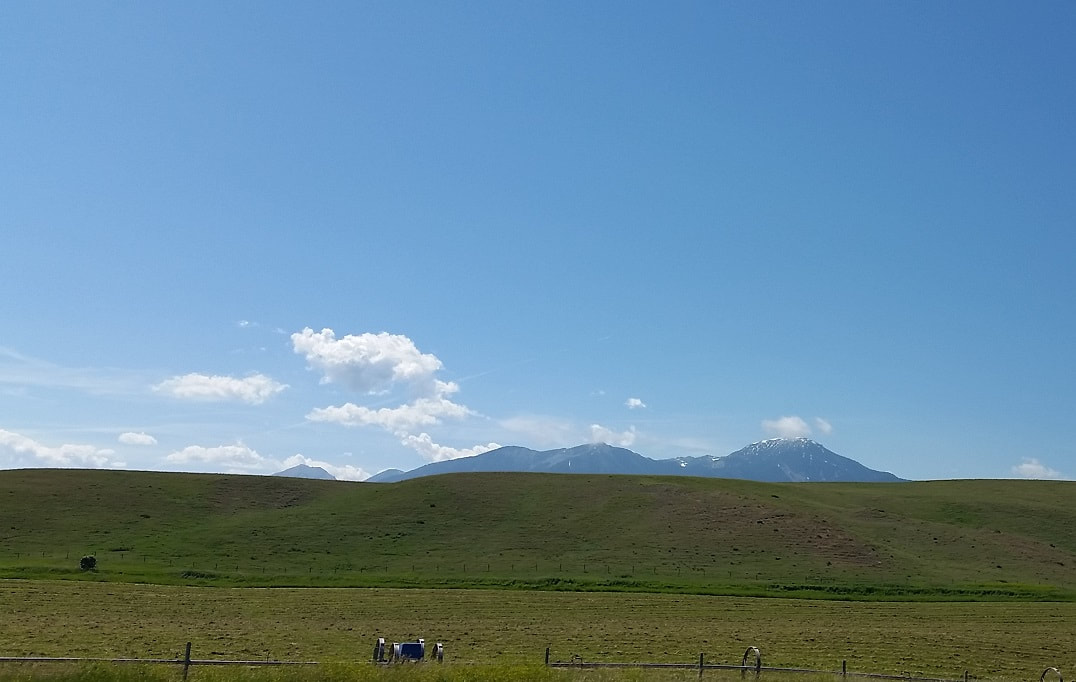 Mountains above the Plains. 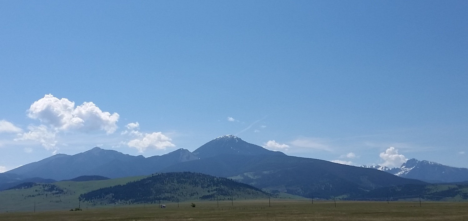 Getting a bit more mountainous. 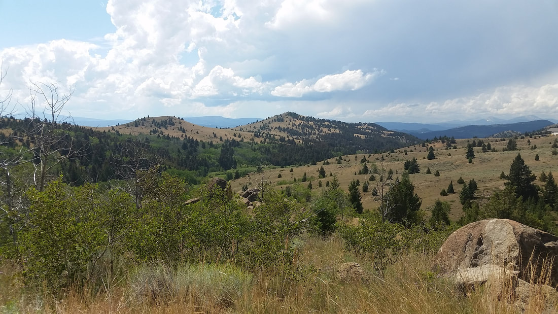 The air is thin up here... 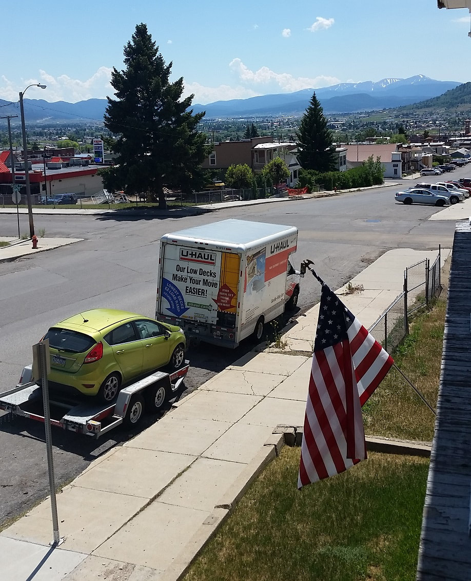 Arrived in Butte, Montana! After unpacking for a few days my next mission was to report for duty as a temporary hydrology field camp instructor for the Indiana University Judson Mead Geologic Field Station in Cardwell, Montana, about 45 miles east of Butte. While most of the students spend the better part of two months at the field camp, at one point they break up into one-week focus sessions on a particular topic other than straight up geologic mapping. One of those sessions was an environmental science/hydrology focus, which I assisted with, being largely ran by Dr. Erika Elswick. The curriculum for the week consisted of such things as the use of water quality probes, how to calculate stream discharge, how to perform pump tests at wells, and in general how to characterize hydrological regimes. This was also a great opportunity for me to get a crash course in western Montana hydrology! 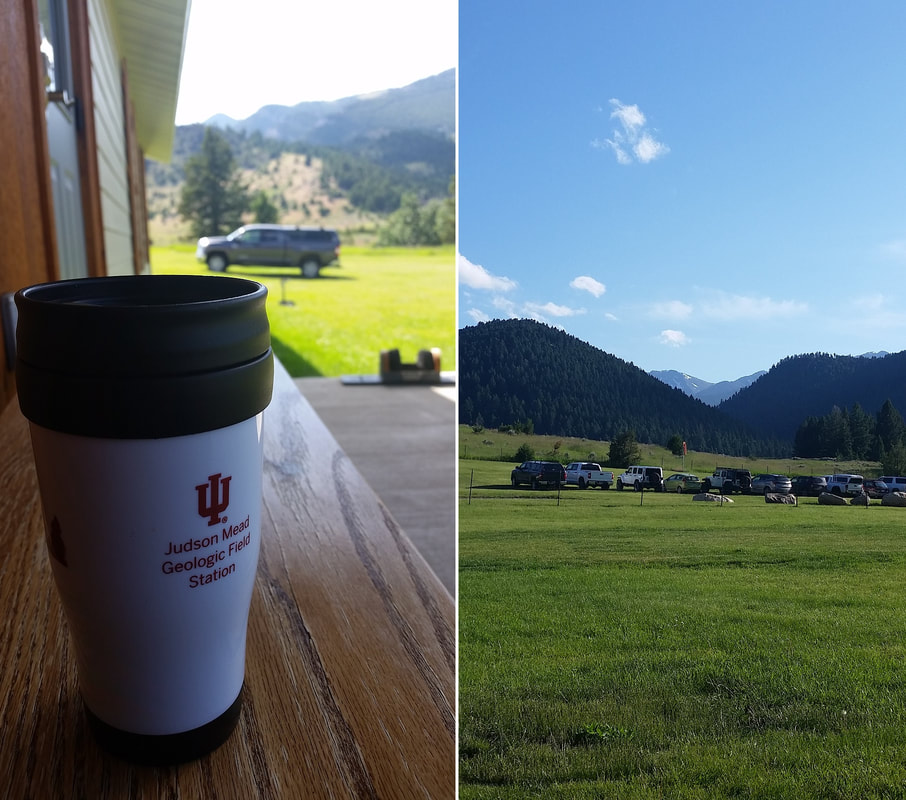 Early days with plenty of coffee (left). Faculty parking lot (right...). 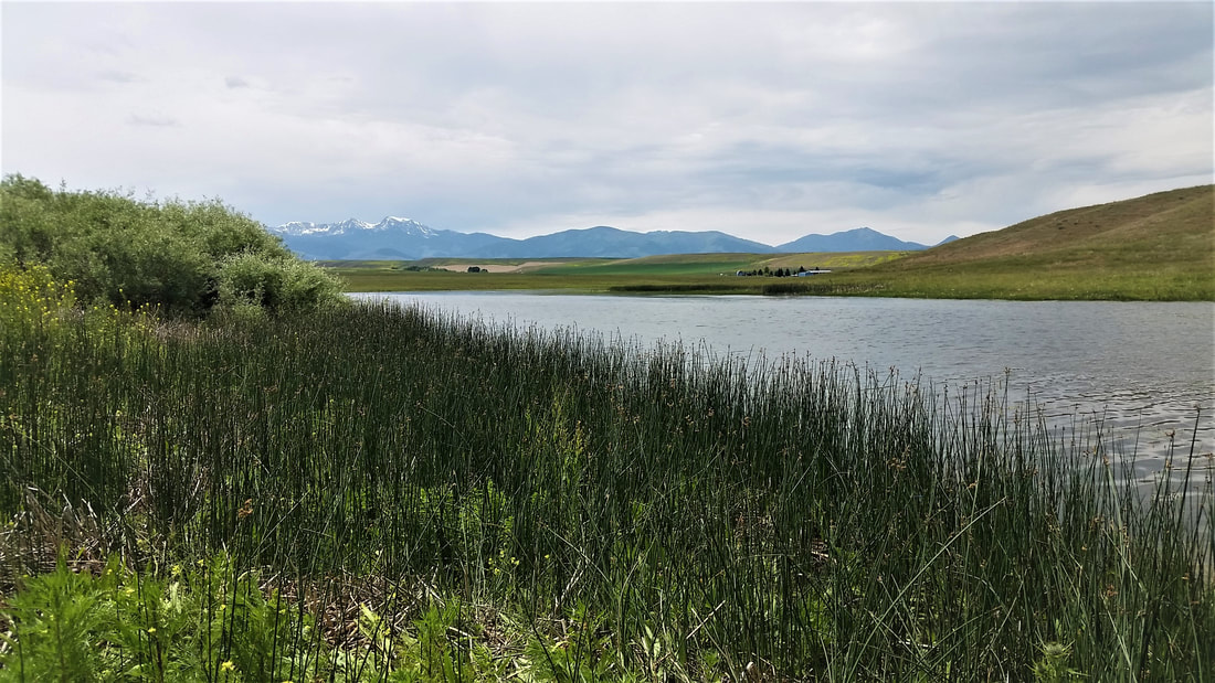 Taking a break from installing seepage meters at Willow Creek Reservoir to enjoy the view. 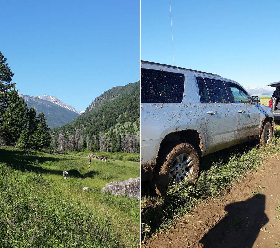 Hiking with the class up to Potosi Hot Springs (left) and getting muddy at one of the well sites (right).  Back to the field station! With my dissertation research wrapped up one of my final duties at Temple University was to help get some drone research underway. This included initial flight training for some of the hydro research team, FAA Part 107 knowledge exam prep, and some test flights for our new Mavic Enterprise 2 Dual drone system. We were first given a bit of an equipment demo from Dr. Martin Helmke at West Chester University, including the Matrice and Mavic drone systems. We also got the opportunity to try out how each drone handled in flight, and the different sensors and cameras they were equipped with. 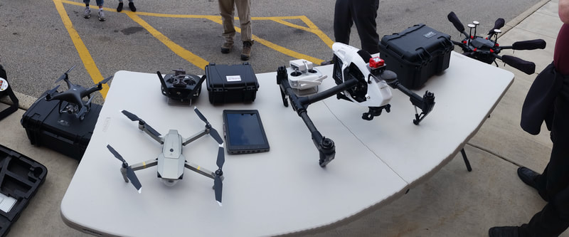 Drone equipment demo. 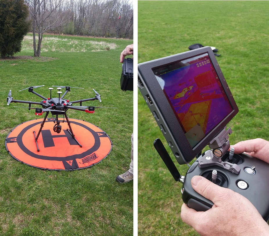 Testing out the Matrice (left) and viewing some of its thermal imagery (right). Happy with what the drones were capable of we moved forward with setting up our own systems and getting some of our team trained. As the only member of the hydro team with aviation and drone experience, this initially meant taking some small steps. While we waited for our Mavic to arrive, we started taking online ground instruction courses on drone flight basics and FAA regulations. As much of this was similar to the training I received for a private pilot certificate I was able to help supplement the learning process. The initial phase of flight training included practicing some very small indoor drones in a lecture hall on campus. These little drones were fairly inexpensive (~$50) and we had plenty of replacement blades so there wasn't too much risk for some inevitable crashes. They also had very little in the way of automated flight capability, requiring the development of some solid "stick and rudder" skills to become good at flying. While the new drone systems essentially fly themselves, it's important to take control of the drone when necessary and be able to fly it manually. 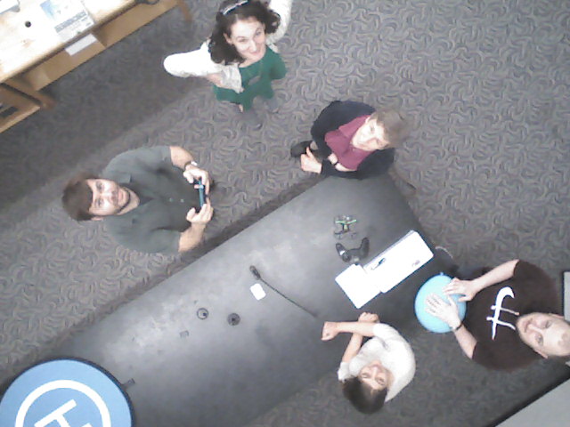 Indoor mini-drone test flight with the first EES Drone Flight research group! The Mavic finally arrived and we began some test flights to get comfortable flying and operating its camera system in the wild, and to get an idea of what it's capable of imaging. We were fairly pleased with the quality of the visible imagery, and happy to see the thermal camera's ability to contrast different materials. 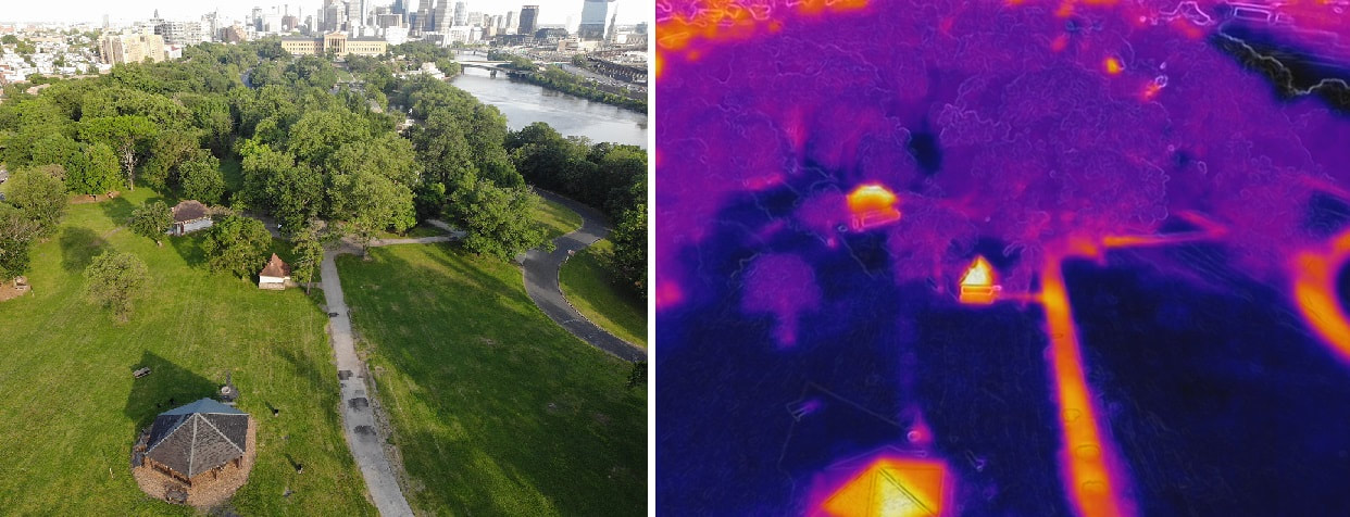 First test flight of the Mavic Enterprise 2 Dual at a park near the Art Museum in Philadelphia (visible image left, thermal image on right). On a trip up to my field sites in central Pennsylvania's Nittany Valley we also tested the drone out in mapping some more rural features such as springs and streams which showed a nice contrast the surrounding ground and trees. 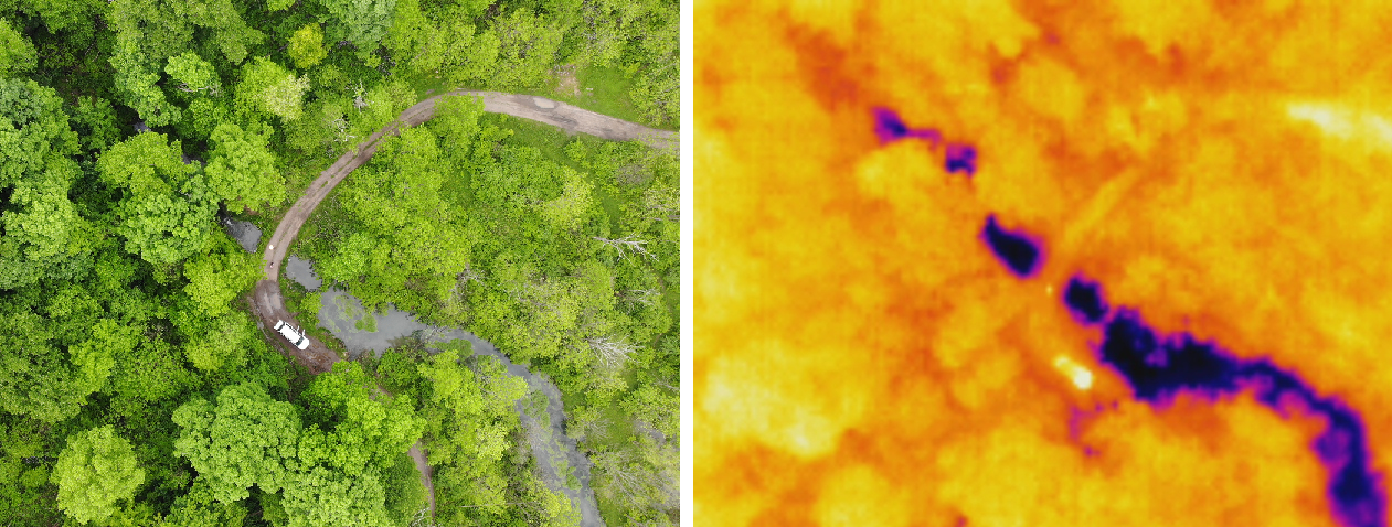 Testing the drone out at a spring site in central PA. The warm department suburban shows up as a warm spot in the thermal imagery, while the water emerging from the spring is cold. We then took the drone out to some of the ongoing field sites to determine its utility for more urban hydrology studies. One of the sites was a small retention basin which appeared to have a surface temperature anomaly, being warmer on the upslope bank and cooler on the downslope bank, which may be indicating seepage into the ground, warranting some follow-up flights. 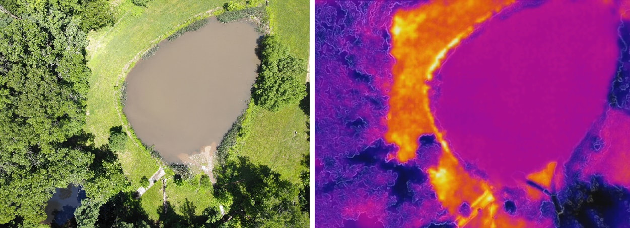 Testing the drone at a retention basin north of Philadelphia looking at thermal anomalies which may indicate seepage. Eventually we were given the heads-up to test the drone out around campus at an empty plot of land which has little to no foot traffic. Being close to the science building this new plot will provide a nice chance to do some test flying without having to drive out to one of the study sites. The last task I was helping with before leaving Temple was to test out the Mavic's auto-surveying abilities where you designate an area you wish to photograph and it determines the flight lines and photograph frequency. During the flight, which was largely photographing straight down, we aimed the camera upward to get a nice shot of campus and downtown Philadelphia! 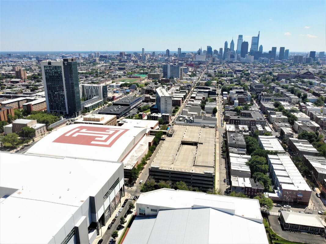 View of Temple University and Philadelphia from the new EES Drone! I'm sad to not be able to be around for the development of this drone research but I look forward to seeing some of the upcoming research! Posing with the Mavic on campus. |
 RSS Feed
