As both a trained geologist and pilot, it was only natural that I developed an interest in geospatial information systems (or maybe it was the other way around?). Viewing the world from a spatial perspective came naturally to me and I've incorporated GIS heavily into my academic and professional career.
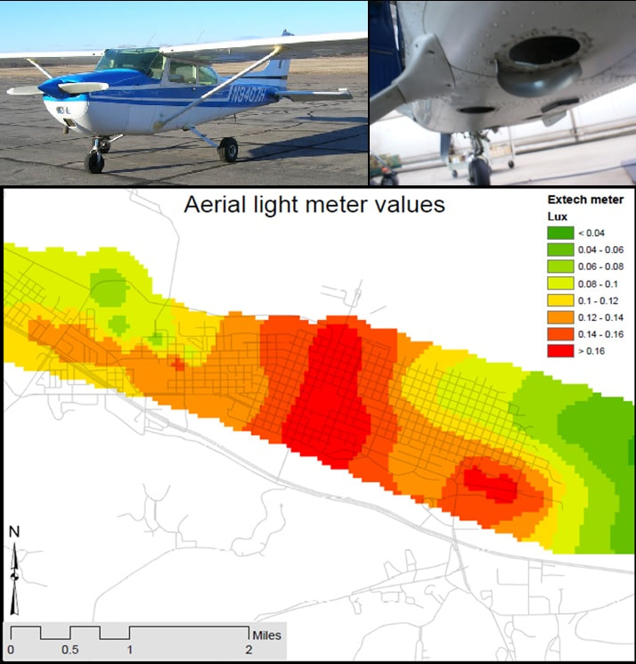
My first research project involved mapping light pollution sources around the city of Winona, Minnesota. In addition to collecting light readings on foot, I also planned an aerial survey to both collect photographs to be georeferenced to produce a nighttime aerial photograph of the city, but I also installed a light meter on the belly of the aircraft to record light levels directly. I then compared the results at the end, which allowed us to determine where the light pollution was concentrated most in the city and what land use and zoning type it was associated with.
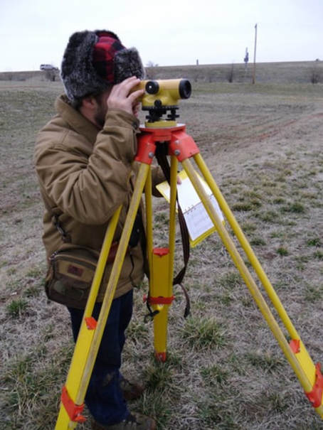
Performing a topographic survey of a sinkhole forming in a detention basin in Springfield, Missouri.
|
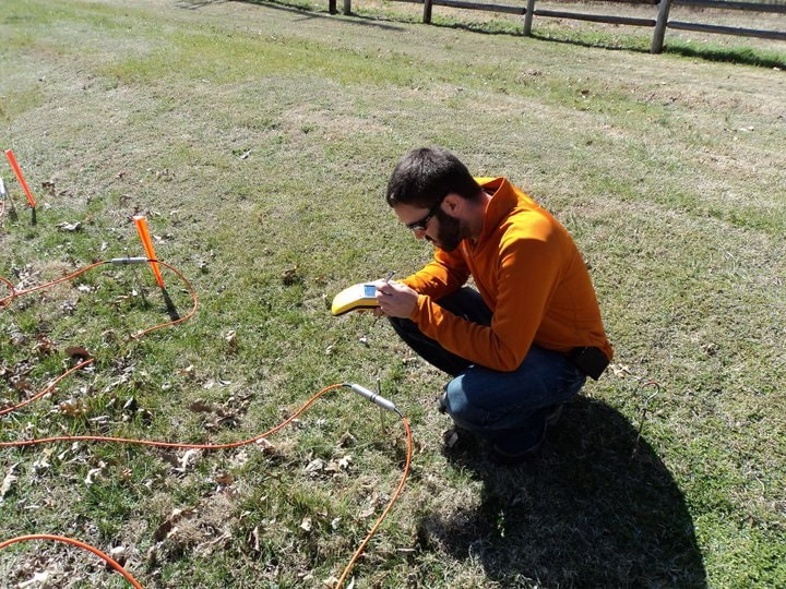
Summer research assistant Scott Healy collecting GPS data of an electrical resistivity survey line near a sinking stream in Springfield, Missouri.
|
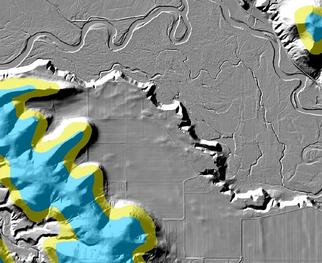
I then went to earn my master's in Geospatial Science in Geology at Missouri State University, where my project incorporated by geological research along with a heavy geospatial component. For my geospatial component I performed 3D geophysical surveys along with sinkhole clustering and sinking stream proximity analysis to characterize the region around Springfield, Missouri.
|
|
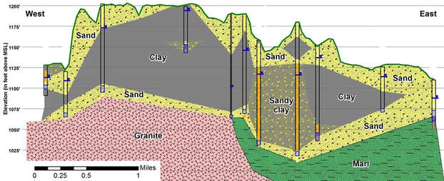
At the Minnesota Department of Health I used GIS daily when preparing wellhead protection plans. This involved analyzing topographic and geologic maps around drinking water wells along with producing geologic cross-sections to characterize the extent of the aquifer or material the wells were drawing water from along with their geologic vulnerability. This information was also used to produce numerical flow models.
|
|
|
|
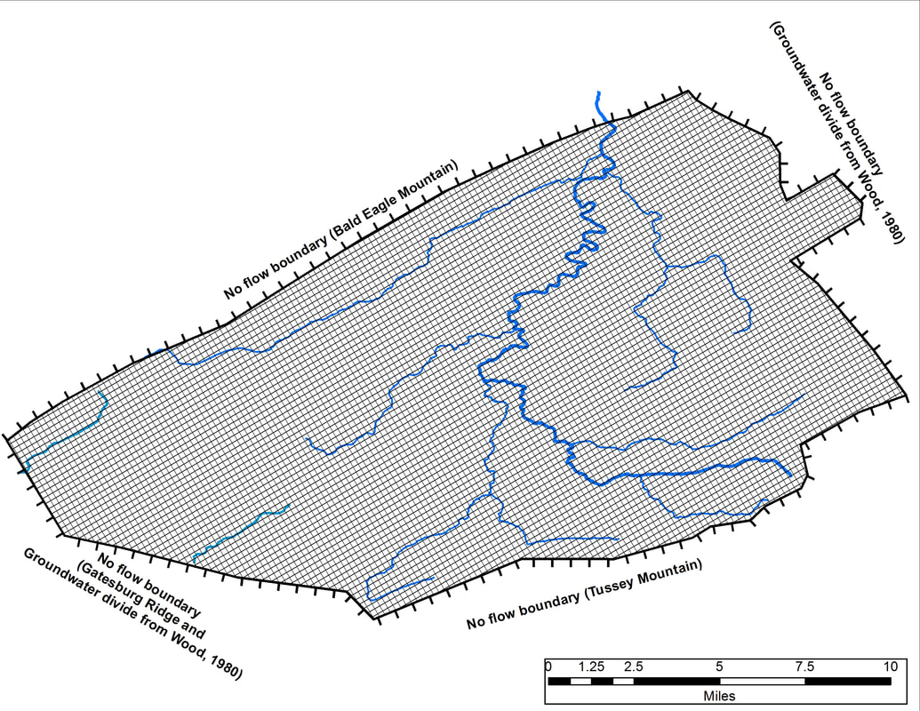
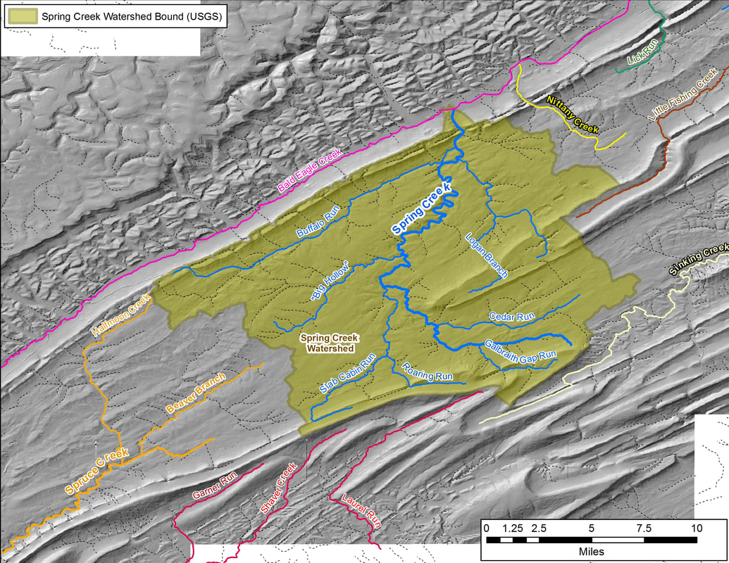
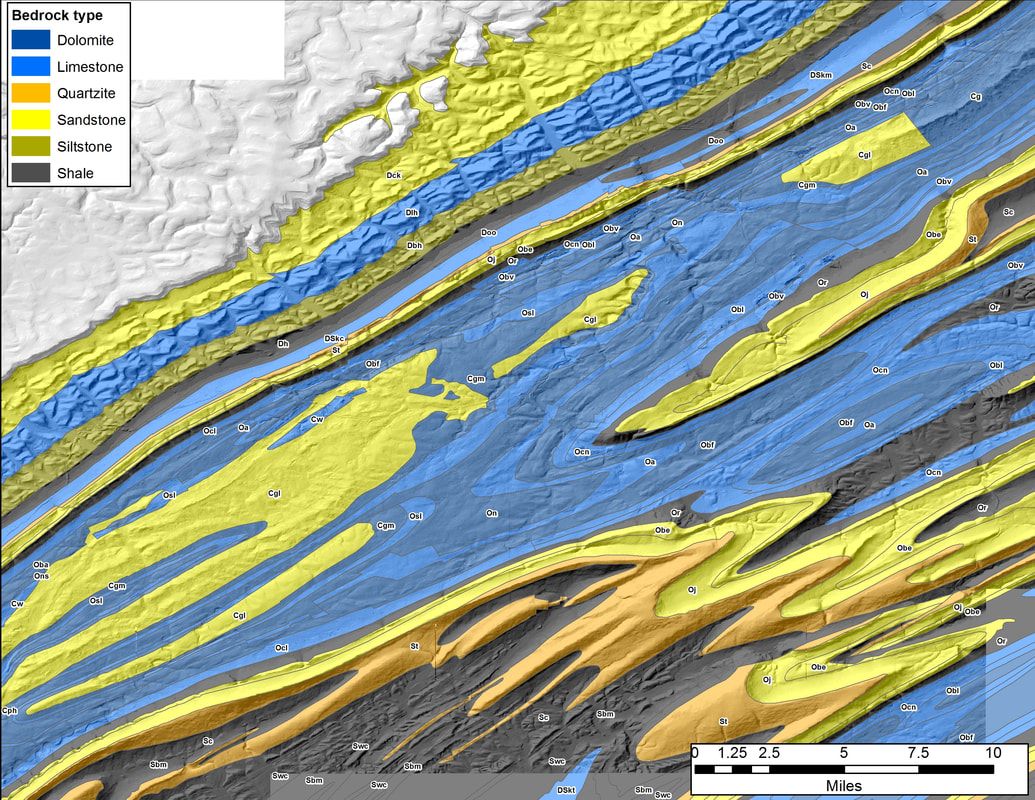
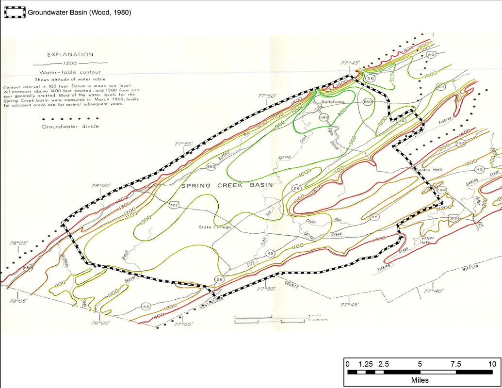
Geospatial information systems have continued to be an invaluable part of my PhD research. Due to the complexities inherent in karst hydrology, along with the complex geology of the Valley and Ridge Province, a thorough understanding of local conditions is necessary through the application of GIS. These geospatial datasets, such as geologic boundaries, stream locations, and land use type are also necessary to produce accurate groundwater flow models within the region. Fortunately, many flow model GUIs and GIS systems communicate well with each other, allowing for the importing of geologic map data directly into a MODFLOW model to zones of different hydrologic conductivities, for example.
