 Posing with the EES Hydrology group's new Mavic Enterprise 2 Dual drone after some test flying.
As an FAA licensed pilot and drone pilot I'm interested in opportunities in which to apply drones in water and environmental resource research. With the growing applicability of drones within geological research I'm hoping to join research teams employing drone-based remoted sensing research methods.
One particularly useful includes the use of thermal imagery for environmental research. This can range from better understanding and mapping urban heat islands to locating and characterizing springs and surface water.
One particularly useful includes the use of thermal imagery for environmental research. This can range from better understanding and mapping urban heat islands to locating and characterizing springs and surface water.
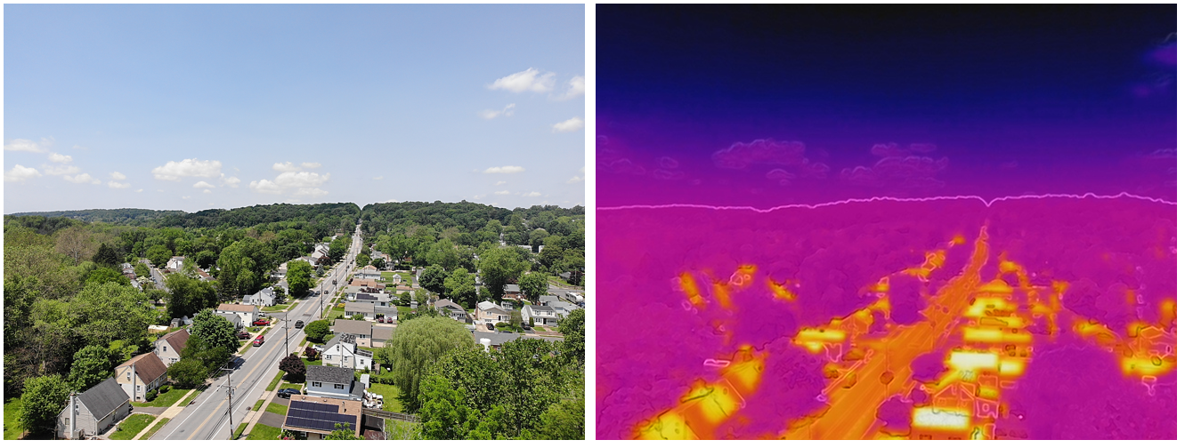
Oblique aerial view of a neighborhood (left) contrasting the radiant heat between roads and buildings with surrounding vegetation (right).
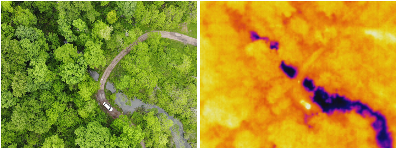
Aerial view of a spring in central PA (left) with its corresponding thermal image contrasting the much cooler spring water relative to the vegetation and dirt road (right).
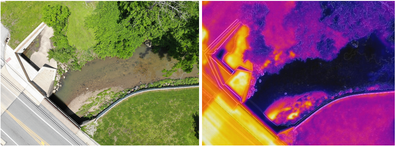
Stream flowing under a highway in southeast PA (left) with corresponding thermal imagery (right) contrasting the temperature of roadways, vegetation, and the stream.
While a useful scientific tool for environmental science, drones are also great for making educational and interesting videos! Below are some videos I have made highlighting projects I've been involved with incorporating drone footage.
